
먼저 코드부터 냅다 올리고 설명을 하겠다!
<FeatureTypeStyle>
<Rule>
<Name>Greater Than 800</Name>
<Title>Greater Than 800</Title>
<ogc:Filter>
<ogc:PropertyIsGreaterThan>
<ogc:PropertyName>food</ogc:PropertyName>
<ogc:Literal>800</ogc:Literal>
</ogc:PropertyIsGreaterThan>
</ogc:Filter>
<PointSymbolizer>
<Graphic>
<Mark>
<WellKnownName>circle</WellKnownName>
<Fill>
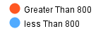
<CssParameter name="fill">#ff5722</CssParameter>
<CssParameter name="fill-opacity">1.0</CssParameter>
</Fill>
</Mark>
<Size>15</Size>
</Graphic>
</PointSymbolizer>
</Rule>
<Rule>
<Name>less Than 800</Name>
<Title>less Than 800</Title>
<ogc:Filter>
<ogc:PropertyIsLessThan>
<ogc:PropertyName>food</ogc:PropertyName>
<ogc:Literal>800</ogc:Literal>
</ogc:PropertyIsLessThan>
</ogc:Filter>
<PointSymbolizer>
<Graphic>
<Mark>
<WellKnownName>circle</WellKnownName>
<Fill>
<CssParameter name="fill">#51abff</CssParameter>
<CssParameter name="fill-opacity">1.0</CssParameter>
</Fill>
</Mark>
<Size>15</Size>
</Graphic>
</PointSymbolizer>
</Rule>
<Rule>
<MaxScaleDenominator>32000</MaxScaleDenominator>
</Rule>
</FeatureTypeStyle>스타일 코드는 기본 1featuretypestyle과 1rule이다
이제 그 안에 rule들을 추가시켜주면 되는 것임
나는 800을 기준으로 초과와 미만의 스타일을 달리 주고 싶었다
그래서 첫번째rule을 grater than 800으로 선언하고 ogcfilter를 추가해준다
ogc filter는 value와 경계를 설정할 수 있다
<ogc:PropertyIsLessThan>: 미만
<ogc:PropertyIsGreaterThanOrEqualTo>: 같거나 큼
<ogc:PropertyIsGreaterThan>: 초과
원하는 필터를 쓰고 property에 기준이 될 value를 지정해주고, literal에 기준이 되는 값을 지정해주면 된다
나는 point라서 point심볼라이저를 썼는데 폴리곤이나 line이라면 각각 지정해주면된다
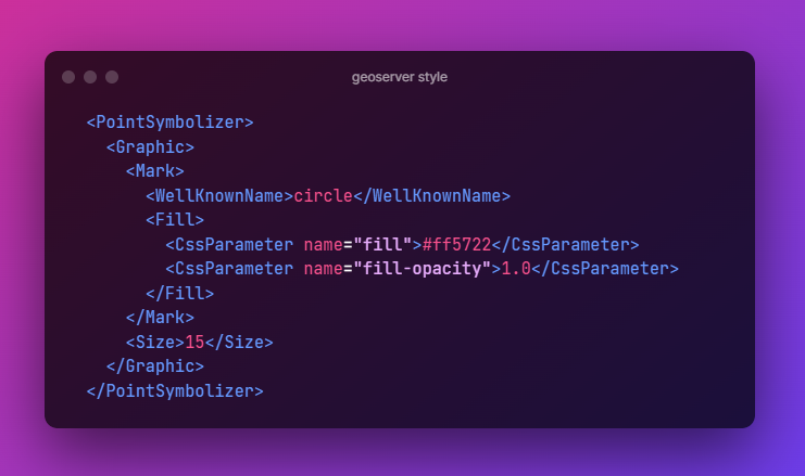
circle을 쓰겠다 라고 넣어주고 해당 색깔과 투명도로 채우겠다라고 지정해줌
size는 당연 사이즈~
참고ref
Points — GeoServer 2.21.x User Manual
Points While points are seemingly the simplest type of shape, possessing only position and no other dimensions, there are many different ways that a point can be styled in SLD. Warning The code examples shown on this page are not the full SLD code, as they
docs.geoserver.org
geoserver사용할때 geoserver docs를 활용하는 것이 참 많은 도움이 되는 것 같다
'QGIS·Geo' 카테고리의 다른 글
| geoserver,openlayers활용하여 heatmap지도에 표출하기 (0) | 2022.09.27 |
|---|---|
| [geoserver]strict-origin-when-cross-origin geoserver의 cross domain(cors)허용 (0) | 2022.08.02 |
| [openlayers, geoserver] 맵에 마우스 올렸을 때 layer feature tooltip 표출하기 (0) | 2022.06.23 |
| [geoserver] SQL 뷰에서 parameter설정, 정규식, 파라미터 오류, 여러개의 변수 구분 (0) | 2022.06.23 |
| [openlayers] openlayers활용하여 웹상에 지도올리기 (0) | 2022.06.21 |


댓글